Getting from Napier to Whangamata
The drive from Napier to Whangamata is one of the most scenic in the North Island, crossing from the Hawke’s Bay wine country over the forested ranges to Taupo, then north through the Waikato to the Coromandel coast. At approximately 370 kilometres and 4 to 4.5 hours of driving, it is a comfortable day trip that passes through some of New Zealand’s most varied landscapes — from vineyard-covered plains to dense native bush, geothermal country, and pastoral farmland.
Distance & Drive Time
- Distance: approximately 370 km
- Drive time: 4 to 4.5 hours (without stops)
- Realistic with stops: 5.5 to 6 hours
- Route: SH5 to Taupo, then SH1/SH27/SH26/SH2/SH25
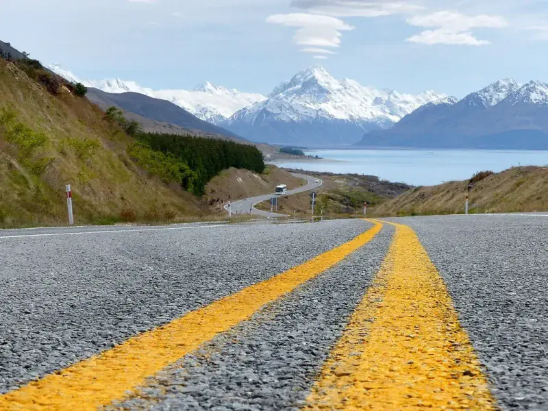
The Route: SH5 Napier-Taupo Highway
The Napier-Taupo Road (SH5) is renowned as one of the most beautiful drives in the North Island. The highway climbs from the coastal plains of Hawke’s Bay, through the Esk Valley wine region, over the forested Kaweka and Ahimanawa Ranges, and down to the shores of Lake Taupo.
- Napier to Bay View — Head north from Napier on SH2, then turn left onto SH5 at Bay View (10 minutes). This is where you leave the coast and head inland.
- Bay View to Titiokura Saddle — The road climbs steadily through the Esk Valley, passing vineyards and olive groves, before entering native bush. The Titiokura Saddle (708 metres) is the high point of the journey, offering panoramic views back over Hawke’s Bay on a clear day. This summit crossing was historically one of the most challenging roads in the North Island, but modern improvements have made it safe and well-maintained.
- Titiokura to Te Pohue — Descend into forests and farmland. There is a rest area at Te Pohue but no fuel services.
- Mohaka River Bridge — One of the dramatic highlights of the drive. The bridge spans a deep, bush-filled valley with the Mohaka River far below. In autumn, the surrounding bush is spectacular.
- On to Taupo — The road crosses the Kaingaroa Plains through pine forests before dropping down to the southern shore of Lake Taupo. Total driving time from Napier to Taupo is approximately 2 hours.
- Taupo to Whangamata — From Taupo, follow SH1 north to Tirau, then SH27 to Matamata, SH26 to Paeroa, SH2 through Karangahake Gorge to Waihi, and finally SH25 over the Hikuai Hill to Whangamata. This second half takes another 2.5 to 3 hours.
Important: No Fuel Between Napier and Taupo
There are no fuel stations on the 150 km stretch of SH5 between Napier and Taupo. This is one of the longest sections of state highway in New Zealand without fuel services. Fill your tank in Napier or Hastings before departure. This is not optional — run out of fuel in the Kaweka Ranges and you will have a very long wait for assistance.
Best Stops Along the Way
- Havelock North and the Hawke’s Bay wineries (before departure) — If you have time, the vineyards around Havelock North, Hastings, and the Gimblett Gravels are some of New Zealand’s finest. This region produces world-class Syrah, Chardonnay, and Cabernet blends. Te Mata Peak offers panoramic views of the region.
- Titiokura Lookout (45 min from Napier) — There is a pull-off area near the summit with views back over Hawke’s Bay and the coast. On a clear day, you can see Cape Kidnappers.
- Taupo (2 hours) — The halfway point. Huka Falls is just 2 minutes off SH1 — do not miss it. DeBretts Hot Springs and the Taupo lakefront are other highlights. This is a natural lunch stop.
- Matamata (3.5 hours) — Hobbiton Movie Set Tours if you are a Lord of the Rings fan.
- Te Aroha (4 hours) — Hot mineral spas and the Mokena Geyser.
- Karangahake Gorge (4.5 hours) — Windows Walk through the old gold mining tunnels.
- Waihi (4.5 hours) — Martha Mine lookout. Last fuel before Whangamata.
Road Conditions
SH5 is a good sealed highway but has winding sections through the ranges. After Cyclone Gabrielle in February 2023, significant repair and improvement work was carried out on this road. Check the NZTA Journey Planner for any ongoing works before departure. The road can be affected by fog in the early morning, particularly around the Te Pohue area.
Fly and Drive Option
Hawke’s Bay Airport in Napier has flights to Auckland. You could fly to Auckland and drive 2.5 hours to Whangamata. However, for a 4-hour drive through beautiful scenery, most people prefer to drive directly from Napier. The drive itself is one of the highlights.
Tips for the Drive
- Fill up with fuel in Napier. No fuel for 150 km. This is the single most important tip for this route.
- The Napier-Taupo highway is popular with logging trucks on weekdays. Be patient and pass safely in designated areas.
- Check road conditions after heavy rain — the SH5 route can be affected by slips in severe weather.
- Stock up on Hawke’s Bay wine before you leave — it pairs perfectly with a Whangamata beach sunset.
- If departing Napier in winter, check for frost and fog warnings on SH5 — the summit sections can be icy in the early morning.