What is Donut Island?
Donut Island — officially named Whenuakura Island — is a small, ring-shaped volcanic island sitting roughly 800 metres offshore in the Whangamata harbour. The island’s distinctive shape gives it its nickname: a complete ring of rock and pohutukawa-covered land enclosing a calm, turquoise lagoon in the centre. At high tide, you can paddle a kayak or SUP straight through the narrow entrance channel into this sheltered inner pool — one of the most unique swimming spots in New Zealand.
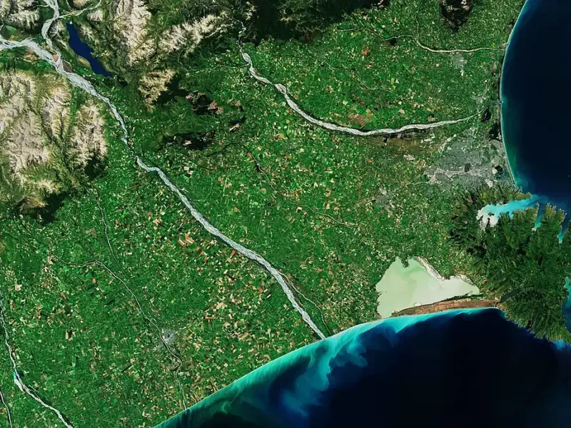
Sea kayaking to island destinations is a popular activity on the New Zealand coast — Donut Island (Whenuakura) is reached by kayak from Whangamata Beach
The island is a protected wildlife area and an important nesting site for seabirds. There are strict rules about what you can and cannot do there, and visiting requires some planning around tides and weather. But for those who make the effort, it is an unforgettable experience.
Whenuakura (Donut) Island
The island sits in the outer harbour, visible from the harbour beach and marina area. The ring of land is roughly 100 metres across, rising a few metres above sea level and covered in pohutukawa and coastal scrub. The inner lagoon is approximately 50 metres in diameter and fills with clear, calm water at high tide — perfect for swimming and snorkelling. The rocky walls of the crater are home to kina (sea urchin), small fish, crabs and colourful sponges. At low tide the lagoon drains to ankle depth and the entrance channel becomes impassable.
Harbour Beach Kayak Launch
The easiest launch point for reaching Donut Island is the harbour-side beach near the marina, at the end of Marina Drive. The sheltered harbour water here is calm and shallow — easy to launch a kayak or SUP from. Several hire operators set up along this stretch during summer, renting single and double kayaks by the hour. The paddle from here to the island takes 20–30 minutes at a steady pace, following the harbour channel south-west towards the island.
Full Day Itinerary: Donut Island by Kayak
Follow this step-by-step itinerary to make the most of a Donut Island day trip from Whangamata. This plan is built around a mid-morning high tide, which is the most common scenario during summer.
The Night Before
- Check the Whangamata tide times for the next day — find the high tide closest to midday and plan your paddle departure for 2 hours before that time
- Check the weather forecast — only go on days with wind below 15 knots
- Book a kayak hire if needed (book in advance during December–January peak period)
- Pack your dry bag: life jacket, togs, sunscreen, water (2L per person), snacks, snorkel and mask, shoes for the rocks, rubbish bag, fully charged phone in waterproof case
8:00am — Breakfast in Town
Start the day with breakfast on Port Road. Most cafes open from 8am. A good feed before a paddle is highly recommended — you will be working harder than you think on the return crossing.
9:00am — Drive to the Harbour
Drive to Marina Drive and park near the harbour beach. Check conditions from the shore — look at the sea state, estimate wind direction and speed. If the water looks choppy with whitecaps, consider postponing.
9:30am — Launch and Paddle to the Island
Hire or launch your kayak from the harbour beach. The paddle to Donut Island takes 20–30 minutes at a steady pace. Keep the island in sight and follow the harbour channel south-west. Avoid the harbour bar area (marked by breaking waves at the harbour entrance).
10:00am–12:30pm — Explore the Island and Lagoon
Arrive at the island’s entrance channel on the north side. At high tide, paddle straight through into the calm inner lagoon. Swim, snorkel along the rocky walls, and soak up the otherworldly atmosphere. This is the experience — a private lagoon inside a volcanic ring, warm water, colourful marine life and complete quiet apart from seabirds.
Eat your snacks and rehydrate. Explore the rocky outer perimeter on foot (wear shoes — rocks are sharp). Watch out for nesting seabirds and stay away from any birds that appear distressed.
12:30pm — Begin Return Paddle
Start heading back before the tide drops too far. The lagoon entrance drains quickly as the tide falls. Paddle back to the harbour beach — the return trip may be slightly harder if an afternoon sea breeze has developed. Stay calm, pace yourself, and keep the harbour in sight.
1:00pm — Return and Lunch
Return the kayak hire, rinse off with the outdoor shower at the harbour toilets, and head to Port Road for a well-earned lunch.
Afternoon Options
The afternoon is free for a beach walk, a visit to Wentworth Falls (30 min drive), a browse of Port Road shops, or simply relaxing on the main beach. If the surf is good, a surf session rounds out the perfect Whangamata day.
How to Get to Donut Island
Donut Island is only accessible by water. There is no ferry service — you need to paddle yourself across in a kayak, on a stand-up paddleboard, or travel by private boat. The crossing takes 20–30 minutes by kayak from the harbour beach.
Step-by-step
- Check the tide: You need to arrive at the island within 1–2 hours of high tide. Check the Whangamata tide chart (available on MetService or local tide apps) and work backwards — allow 30 minutes for the paddle across
- Check the weather: Only go on calm days. Wind over 15 knots makes the crossing difficult and potentially dangerous. Easterly winds are the worst as they push against you on the return paddle
- Launch from the harbour beach: Head to Marina Drive and launch from the calm harbour-side beach
- Paddle south-west: Keep the island in sight and follow the harbour channel. Stay well clear of the harbour bar at all times
- Enter the lagoon: The entrance channel is on the northern side of the island. At high tide it is deep enough to paddle through. If you have to drag your kayak, the tide is too low
- Return before the tide turns: Do not linger too long. Once the tide starts dropping, the lagoon drains quickly and the harbour currents strengthen as water flows out
Tidal Requirements
Timing your visit around the tides is critical. The lagoon entrance channel is only navigable from about 2 hours before high tide until 1 hour after high tide. Outside this window, the channel is too shallow to paddle through and you will be stuck outside the island (or inside it, waiting for the next high tide).
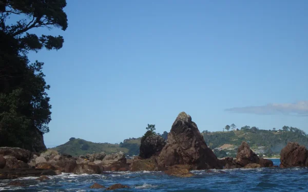
The Coromandel coastline is dotted with small islands accessible only by kayak or boat — Donut Island (Whenuakura) is one of the most spectacular
The outgoing tide is the main safety concern. As the tide drops, the entire harbour drains through the entrance channel past the bar. This creates powerful currents that can easily sweep a kayak or paddleboard towards the open ocean. Always plan your return trip to coincide with slack water or an incoming tide.
What to Bring to Donut Island
- Life jacket: Mandatory. You must wear one for the crossing
- Sunscreen and hat: There is zero shade on the island
- Water: At least 1 litre per person — there is no fresh water on the island
- Dry bag: For your phone, keys and valuables
- Snorkel and mask: The lagoon has clear water and interesting marine life along the rocky edges
- Shoes: The rocks around the island are sharp. Reef shoes or old sneakers are recommended
- Rubbish bag: You must take everything out with you. Leave no trace
Swimming in the Crater Lagoon
The lagoon is the main attraction. At high tide it fills with clear, calm water about 2–3 metres deep in the centre, warmed by the sun on the surrounding rocks. Swimming here feels like your own private pool in the middle of the ocean. The rocky walls are home to kina, small reef fish and colourful marine life — bring a mask for a closer look. The water is noticeably warmer than the open harbour due to the sheltered, shallow nature of the lagoon.
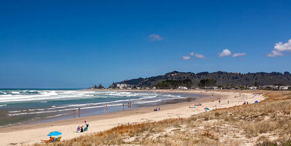
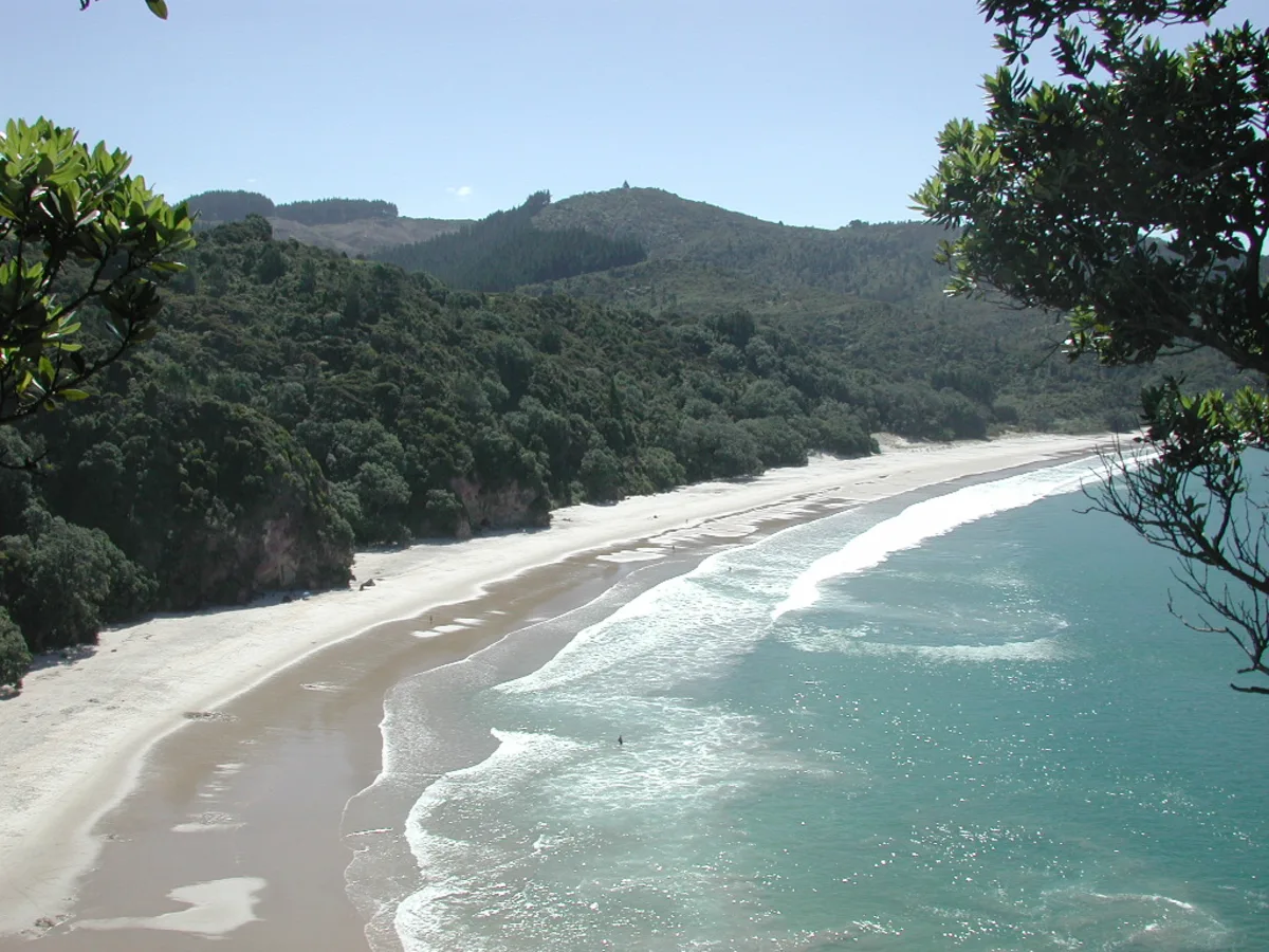
The kayak trip to Donut Island departs from Whangamata Beach — the island is visible on clear days from the shoreline
Wildlife & Environment
Whenuakura Island is an important habitat for nesting seabirds, including white-fronted terns, red-billed gulls and variable oystercatchers. During nesting season (October–February), be extremely careful where you walk and do not disturb any birds or nests. Stick to the rocky shoreline and avoid climbing into the vegetated areas.
The island is also home to native coastal plants including pohutukawa, karo and flax. The marine environment around the island is rich and healthy — another reason to treat the area with respect.
Rules & Restrictions
- No dogs: Dogs are not permitted on the island at any time
- No fires: Absolutely no fires, barbecues or cooking
- No camping: Day visits only
- No rubbish: Pack out everything you bring in
- No collecting: Do not take shells, rocks, plants or marine life
- Respect wildlife: Do not disturb nesting birds or marine animals
Safety Summary
- Always wear a life jacket for the crossing
- Only paddle in calm conditions with light winds
- Time your trip around high tide — never paddle on an outgoing tide
- Tell someone where you are going and when you expect to return
- Take a fully charged phone in a waterproof case or dry bag
- If conditions change while you are on the island, wait it out rather than risk the crossing
- The harbour bar is extremely dangerous — stay well away from the harbour entrance at all times