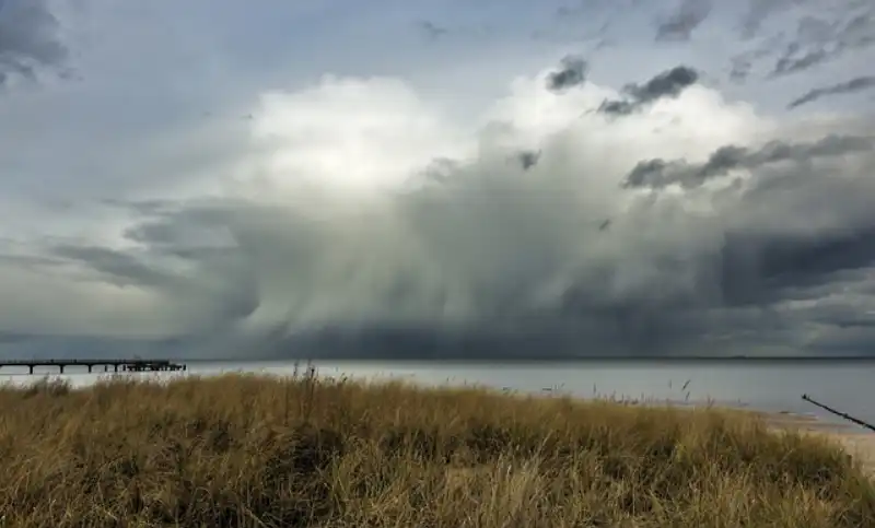
WHANGAMATA, New Zealand — After a summer of record-breaking heat and unseasonably dry conditions, Whangamata is now facing a turbulent autumn marked by intense storms, accelerating coastal erosion, and a flurry of conservation activity aimed at protecting the town’s unique marine and bush environments. Local residents and authorities are watching the weather closely as the Coromandel Peninsula experiences some of the most volatile seasonal shifts in recent memory.
According to data from the Thames-Coromandel District Council, the Whangamata area recorded 45mm of rain in a single 24-hour period last week, a figure that meteorologists say is nearly double the historical average for mid-March. The deluge, accompanied by gale-force winds gusting up to 90 km/h, caused minor flooding along Beach Road and forced the temporary closure of the Port Road boat ramp due to debris and shifting sand.
“We haven’t seen a storm like that since Cyclone Gabrielle in 2023,” said Margaret Hauraki, a Whangamata resident of 30 years and owner of the Beachside Café on Beach Road. “The waves were crashing right over the seawall. The sand on the main beach has just disappeared in some spots. It’s heartbreaking.”
Coastal erosion reaches critical point
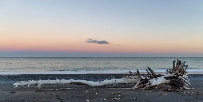
The storm surge has exacerbated long-standing erosion issues along the Whangamata Harbour entrance and the foreshore near Williamson Park. Council engineers have been monitoring the situation daily, with particular concern for the stretch between the surf club and the southern end of the main beach.
“We’ve lost an estimated three metres of dune width in some areas since January,” said Tom Rangi, a coastal management specialist contracted by the Thames-Coromandel District Council. “The combination of rising sea levels and these more intense storm events is accelerating the erosion rate beyond what our models predicted. We’re looking at emergency sand replenishment later this winter if the trend continues.”
The council has placed large sandbags and temporary barriers along the most vulnerable sections of the foreshore, but locals fear that without a long-term strategy, properties along Beach Road and the harbourfront could be at risk.
“We’ve been talking about a managed retreat for years, but nobody wants to face it,” said Sarah Mitchell, chair of the Whangamata Ratepayers’ Association. “The council needs to come up with a plan that balances protecting our beaches with the reality of climate change. We can’t just keep throwing sand at the problem.”
SH25 and Port Road under pressure
The recent weather has also taken a toll on local infrastructure. State Highway 25, the main arterial route into Whangamata, experienced multiple slips between Hikuai and the town centre, causing delays for commuters and freight. The council’s roading team has been working around the clock to clear debris, but further slips are expected with more rain forecast for the coming week.
Port Road, a key access point for boaties and the harbour community, suffered surface damage from the storm surge, with sections of the asphalt undermined by wave action. The council has cordoned off the affected area and is conducting structural assessments.
“Port Road is vital for our fishing and tourism industries,” said David Chen, owner of the Whangamata Marina. “If that road goes, it cuts off access to half the harbour. We need a proper sea wall, not just temporary fixes.”
Conservation boost: DOC and community unite
Amid the weather-related challenges, there is positive news on the conservation front. The Department of Conservation (DOC) has announced a new partnership with the local volunteer group Whangamata Harbour Care to restore native vegetation along the harbour margins and the dunes of Williamson Park.
Starting this month, the project aims to plant 10,000 native trees and shrubs, including pōhutukawa, flax, and sand tussock, to stabilise the soil and provide habitat for native birds and lizards. The initiative is funded by a $50,000 grant from the Ministry for the Environment’s Community Environment Fund.
“This is a fantastic example of the community stepping up,” said Anna Te Whare, DOC’s Coromandel operations manager. “The planting will not only help prevent erosion but also improve water quality in the harbour by filtering runoff. We’re also working with local iwi to incorporate mātauranga Māori into the restoration plan.”
Volunteer days are scheduled for the first Saturday of each month through September, with meeting points at Williamson Park car park. Residents are encouraged to bring gloves and spades.
Marine environment under the microscope
The health of Whangamata’s marine environment is also a growing concern. The recent storms have churned up sediment from the harbour and offshore, reducing water clarity and temporarily affecting the local snapper and kingfish populations. The Waikato Regional Council has issued a temporary health warning for shellfish gathering along the coast due to elevated bacterial levels from stormwater runoff.
“We advise people to avoid collecting shellfish from the Whangamata Harbour and nearby beaches for at least two weeks after heavy rain,” said Dr. Lisa Brown, a marine scientist with the Waikato Regional Council. “The bacteria levels can spike dramatically after a big storm, and it’s not worth the risk.”
Local divers have also reported an increase in crown-of-thorns starfish in the deeper waters off Whangamata, a species that can decimate coral and sponge gardens. DOC is monitoring the situation and may initiate a removal program if numbers continue to rise.
“The marine ecosystem here is incredibly rich, but it’s under pressure from multiple directions,” said Jake Morrison, a dive instructor at Whangamata Dive Centre. “Warmer water, more storms, and now these starfish — it’s a reminder that we need to take care of our ocean as much as our land.”
What’s next for Whangamata?
The Thames-Coromandel District Council is scheduled to hold a public meeting on April 10 at the Whangamata Community Centre to discuss the coastal erosion management plan and to update residents on infrastructure repairs. The meeting will include presentations from council engineers, DOC representatives, and local iwi.
Meanwhile, Metservice is forecasting a further 50-70mm of rain over the next week, with strong northeasterly winds expected to bring heavy swells. The council has advised residents in low-lying areas near the harbour to prepare sandbags and to monitor the council’s emergency alerts.
“We’re resilient here,” said Margaret Hauraki, wiping sand from her café’s doorstep. “We’ve weathered storms before, and we’ll weather this one. But we need the council and the government to take our future seriously. This isn’t just about a bad week — it’s about the next 50 years.”
FAQ
Q: Is it safe to swim at Whangamata Beach right now?
A: Water quality can be affected by stormwater runoff after heavy rain. It is best to avoid swimming for at least 48 hours after a significant rainfall event. Check the Waikato Regional Council’s “Can I Swim Here?” website for up-to-date water quality results.
Q: How can I help with the dune restoration planting?
A: Volunteer days are held on the first Saturday of each month at Williamson Park car park at 9am. All tools and plants are provided. You can also contact Whangamata Harbour Care via their Facebook page for more information.
Q: What should I do if I see coastal erosion worsening near my property?
A: Report it immediately to the Thames-Coromandel District Council’s infrastructure team on 07 868 0200. Do not attempt to move sand or build your own barriers, as this can exacerbate the problem and may require resource consent.