The Coromandel Peninsula sits on steep, soft, slip-prone hill country, and its main highways — State Highway 25 (the loop road around the peninsula) and State Highway 25A (the Kōpū–Hikuai shortcut over the ranges) — can close or drop to a single lane with very little notice after heavy rain. This page is your one-stop hub: how to check the live, official status before you drive, where the known recurring trouble spots are, the official links and map you need, and what to do if your route is shut. We deliberately do not publish a “today” status here, because it changes by the hour — always confirm with the official sources below right before you leave.

⏱️ Check before you go: NZTA Journey Planner (live) • 💲 Cost: Free • 🚧 Worst after: Heavy rain / ex-tropical storms • 📍 Covers: SH25 loop + SH25A Kōpū–Hikuai
Check live road status first (official sources)
Conditions on the Coromandel can flip from “open” to “closed” within an hour of heavy rain, so always check a live source the morning you travel — not a blog, news article, or social post from days earlier. These are the authoritative, real-time tools:
| Source | Best for | Link |
|---|---|---|
| NZTA Journey Planner | Live state-highway closures, slips & delays on SH25 / SH25A | journeys.nzta.govt.nz |
| NZTA traffic bulletins | Coromandel-specific updates & planned closures | Coromandel bulletins |
| NZTA 0800 line | Phone updates if you have no data signal | 0800 4 HIGHWAYS (0800 44 44 49) |
| TCDC Road Conditions | Local (non-state-highway) roads in the district | tcdc.govt.nz |
| SH25/SH25A project page | Resilience works, planned roadworks & background | NZTA project page |
| Coromandel CFM “Roads” | Plain-language local roundup from the regional radio station | cfm.co.nz/roads |
Tip: mobile coverage is patchy over the ranges and at remote bays, so screenshot the latest status (and your alternative route) before you lose signal.
Live map — the Coromandel highway network
Use the map below to orient yourself. SH25 is the big loop hugging the coast all the way around the peninsula; SH25A is the inland shortcut cutting across from Kōpū (near Thames) to Hikuai (near Tairua/Pauanui). When SH25A is shut, everyone is funnelled back onto the longer SH25 coast roads.
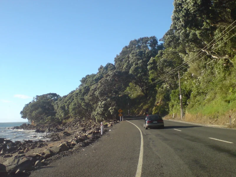
Known recurring slip & trouble spots
After major storms the same handful of locations tend to slip, drop a lane, or get a temporary 50 km/h limit. These are not a live status — they’re the spots to watch and to factor into your timing. Any of them can be fully open today and shut tomorrow, so still check Journey Planner.
On SH25 (the coastal loop)
- Whangapoua Hill — a repeat slip site between Whangapoua/Matarangi and Coromandel Town; has carried temporary 50 km/h limits past the repair.
- Kūaotunu Hill — a large, complex underslip site on the road between Whitianga/Matarangi and Kūaotunu; repairs here are slow and lane closures recur.
- Pumpkin Hill, north of Tairua — multiple underslips along a roughly 3 km stretch, with lane closures and stop/go in wet spells.
- Opoutere — slip sites on the stretch between Whangamatā and Tairua.
- Wade Road, south of Whitianga — clean-up and underslip works after storms.
On SH25A (Kōpū–Hikuai)
The big one was the Taparahi slip, which collapsed a 110 m section of the road over the ranges after the January 2023 storms and Cyclone Gabrielle, severing the fastest link between Thames and the eastern bays. A new 124 m bridge was built in under seven months and the road reopened in December 2023. SH25A is open again, but it’s a high, exposed mountain route — expect occasional weather-related closures, fog, and ongoing maintenance stops.
If your route is closed — detours & planning
Because SH25 is a loop, a closure usually means going “the long way round” rather than not getting there at all — but it can add a lot of time. A few principles:
- SH25A shut? Use SH25 via Thames and the coast (north via Coromandel Town, or south via Whangamatā) to reach the eastern bays. Add 1–2+ hours depending on where you’re headed.
- A coastal section of SH25 shut? You may be able to reach the same town from the opposite side of the loop — check the map and let Journey Planner route you.
- Build in buffer time for ferries, tides and dig-your-own-pool timing if you’re connecting to Hot Water Beach or a Cathedral Cove boat trip.
- Long weekends: the network is busiest (and most likely to back up at a stop/go) on public holidays — leave early.
Typical drive times (when all roads are open)
These are clear-road estimates; add buffer in rain or holiday traffic.
| Route | Approx. distance | Approx. time |
|---|---|---|
| Auckland → Whangamatā | ~165 km | ~2 hr 15 min |
| Thames → Tairua via SH25A | ~45 km | ~40 min |
| Whangamatā → Whitianga (SH25) | ~70 km | ~1 hr 5 min |
| Thames → Coromandel Town (SH25) | ~55 km | ~50 min |
Planning the drive up from the city? See our Auckland to Whangamatā guide, and for the wider region browse the Coromandel hub and our peninsula local’s guide. Heading to a specific town? We have day-trip guides for Whitianga & Mercury Bay and Coromandel Town.
Get directions to key gateway towns
Thames (SH25/SH25A junction):
🗺️ Directions (Google Maps)🚗 Open in Waze
Whangamatā:
🗺️ Directions (Google Maps)🚗 Open in Waze
Frequently asked questions
Is SH25A (the Kōpū–Hikuai road) open?
Yes — SH25A reopened in December 2023 after a new bridge replaced the Taparahi slip that severed the road in early 2023. It’s the fast inland link between Thames and the eastern bays, but as a high mountain route it can still close in severe weather or for maintenance. Confirm on NZTA Journey Planner before you rely on it.
How do I check Coromandel road closures right now?
Use the NZTA Journey Planner and Coromandel traffic bulletins linked above for state highways (SH25/SH25A), and the TCDC site for local roads. For a quick spoken roundup, the local CFM “Roads” page is handy. Avoid relying on old news articles or social posts — the situation changes hourly in wet weather.
Why does SH25 keep slipping and closing?
The Coromandel’s highways are cut into steep, soft, geologically young hillsides that sit above the sea. Intense rain — increasingly from ex-tropical storms — saturates the slopes and triggers underslips and dropouts at the same vulnerable points (Whangapoua Hill, Kūaotunu Hill, Pumpkin Hill, Opoutere). NZTA’s SH25/SH25A programme is progressively rebuilding these to be more resilient.
Can I still get to Whangamatā, Whitianga or Cathedral Cove if a road is closed?
Usually yes, because SH25 is a loop, so you can often approach a town from the other direction — it just takes longer. Plan extra time, check Journey Planner for the live picture, and see our guides to Mercury Bay and the wider things to do in the Coromandel.