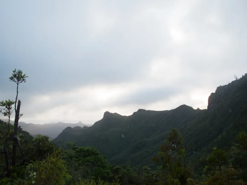
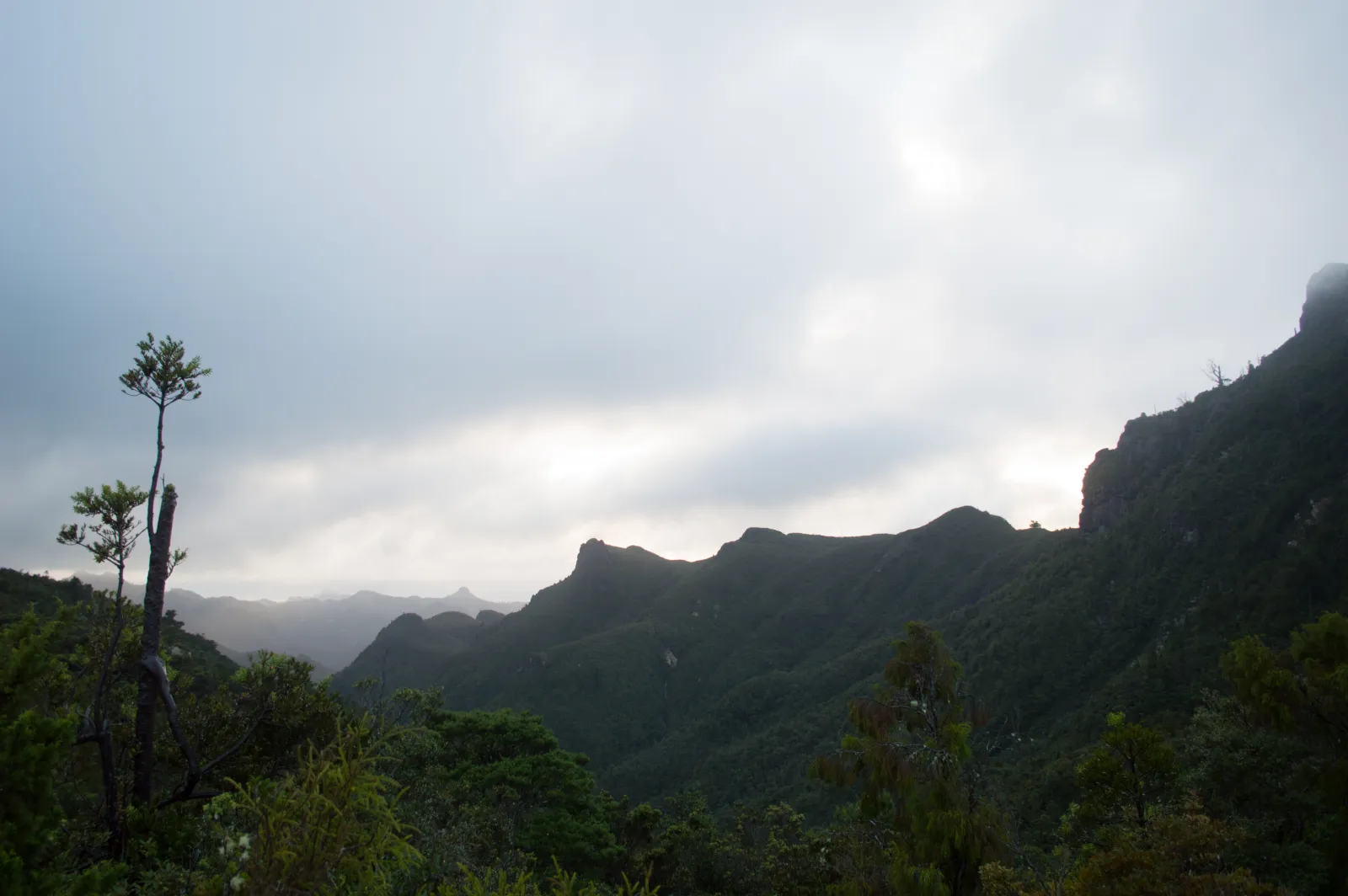
Coromandel Forest Park is the wild green spine of the Coromandel Peninsula — roughly 70,000 hectares of regenerating kauri forest, fern-draped gullies and volcanic ridgelines stretching from Thames almost to the peninsula’s tip. For most visitors the heart of it is the Kauaeranga Valley, a single road that delivers you to a DOC visitor centre, nine riverside campsites and 21 walking tracks — including the famous climb to the Pinnacles. This guide pulls together the tracks, camping, drive times and booking details that are otherwise scattered across half a dozen official pages, so you can plan the whole trip from here.
⏱️ Time: Half-day to 2 days • 💲 Cost: Free to walk; camping ~$10/adult, Pinnacles Hut booked online • 🥾 Effort: 20-min strolls to a strenuous 8 hr summit climb • 📍 Near: Thames (15–20 min to visitor centre)
Where it is and how to get there
The gateway is the Kauaeranga Valley, reached via Kauaeranga Valley Road off SH25 just south of Thames. The road is sealed for about 13 km to the DOC Kauaeranga Visitor Centre (15–20 minutes from Thames), then continues as roughly 9 km of gravel to the road-end car park where most walks — including the Pinnacles track — begin. Drive that last stretch slowly; it’s narrow, dusty and shared with logging-era one-lane bridges.
Typical drive times: Thames to the visitor centre ~20 min; Auckland to the trailhead ~2 hr 30 min (about 155 km); from Whangamata allow around 1 hr 15 min over to Thames. If you’re basing yourself on the east coast, see our Coromandel Peninsula local’s guide and the Coromandel hub for the wider lay of the land, or the Auckland to Whangamata route if you’re coming from the city.
🗺️ Directions (Google Maps)🚗 Open in Waze
Start at the Kauaeranga Visitor Centre
Make this your first stop. DOC rangers here have firsthand knowledge of track and river conditions, weather, hut and campsite availability, and the valley’s kauri-logging history (there are old dam replicas in the forest). It’s also where you pay for camping if you haven’t booked online. Hours are typically 8:30 am–4:30 pm daily, extended to about 5:30 pm over the peak summer period (roughly mid-December to early February). Toilets, water and interpretive displays are on site. Always check the official DOC Kauaeranga Valley page for live alerts before you drive in, as the gravel road and tracks can close after heavy rain.
The best walks and tracks
The valley offers everything from a 20-minute family stroll to a full-day summit slog. Here are the standouts; times are one-way unless noted as return or loop.
| Track | Time | Difficulty | Highlight |
|---|---|---|---|
| Kauri dam replica / short loops | ~20–40 min return | Easy | Historic logging dam, good for kids |
| Cookson Kauri Walk (from Wainora) | ~1–1.5 hr | Easy–moderate | Mature kauri, river views |
| Pinnacles via Webb Creek (to hut) | ~2 hr 30 min up | Moderate–hard | Historic stone packhorse steps |
| Pinnacles summit (from hut) | ~1 hr 15 min return | Hard (ladders) | 759 m panoramic lookout |
| Pinnacles loop (Webb Creek + Billygoat) | ~7–8.5 hr full day | Hard | Waterfall views on Billygoat |
| Moss Creek Track | ~2–2.5 hr up | Hard (steep, boggy) | Remote dam site, fewer crowds |
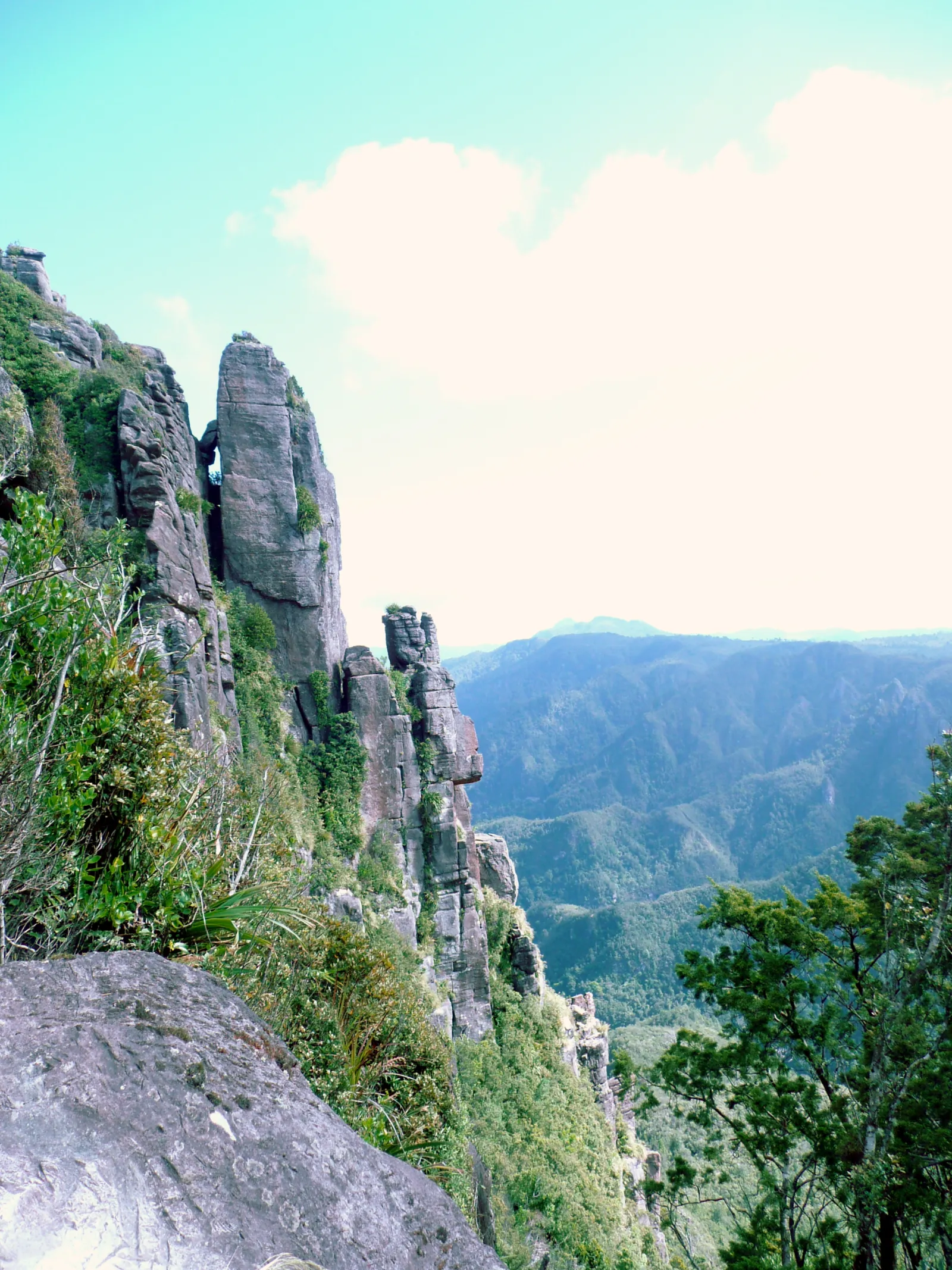
The Pinnacles — the park’s signature climb
This is why most people come. The classic route follows the Webb Creek Track, climbing a beautifully built stone staircase laid by kauri bushmen in the 1920s up to the 80-bunk Pinnacles Hut (about 2 hr 30 min from the car park). From the hut it’s a steep 1 hr 15 min return scramble to the summit — the final section involves fixed ladders and steep drop-offs, so it’s not for anyone uneasy with heights, and it should be avoided in high wind or wet rock. The reward is a 759 m lookout over the entire southern Coromandel. You can do it as a long day walk (allow ~7–8 hours for the loop) or stay overnight at the hut. For a deeper dive into the climb, gear and conditions, read our dedicated Pinnacles / Kauaeranga Valley track guide.
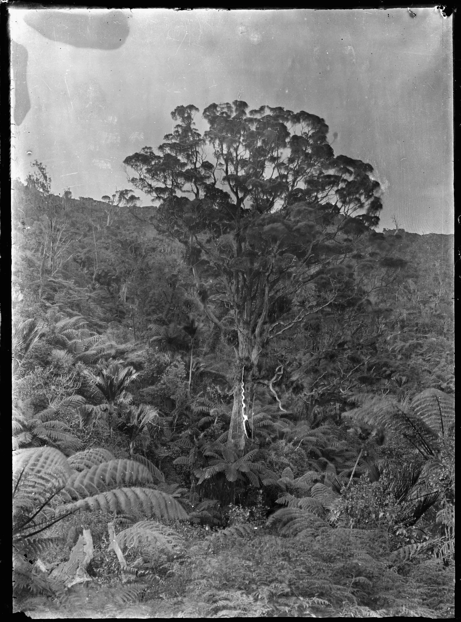
Protect the kauri — every time
Coromandel Forest Park is kauri country, and kauri dieback disease is spread by a single grain of contaminated soil. Scrub and spray your boots at the cleaning stations at every track entrance and exit, stay on the formed track, and never touch kauri roots. It takes a minute and keeps these giants alive.
Camping in the valley
There are nine DOC conservation campsites strung along the Kauaeranga River, most with basic toilets, river swimming holes and vehicle access. They’re popular and busy in summer — book online in advance. If you turn up unbooked and staff have to process you on site, expect a service charge (around $10) on top of the fee.
| Site | Good for | Typical fee* |
|---|---|---|
| Wainora | Cookson Kauri Walk, river views | ~$10 adult / $5 child |
| Trestle View | Closest to the Pinnacles trailhead | ~$10 adult / $5 child |
| Whangaiterenga, Hotoritori, Shag Stream, others | Family riverside camping | ~$10 adult / $5 child |
| Pinnacles Hut (80 bunks) | Overnight Pinnacles trampers | Booked online; serviced hut rate |
*Fees are indicative and change — infants (0–4) are usually free and children (5–17) about half price. Check the current rate when you book on the DOC Coromandel Forest Park booking pages. Hut and trailhead-campsite rates were updated in mid-2026.
Prefer a roof, a hot shower and a proper bed? Browse Whangamata accommodation for an east-coast base, or stay near the western gateway around Coromandel Town.
What to pack and when to go
The valley is walkable year-round, but conditions change fast. Bring sturdy boots, layers, plenty of water, and a rain shell even on clear mornings — the Pinnacles make their own weather. Summer (Dec–Mar) is warmest and best for river swimming but busiest; autumn is quieter with stable trails. After heavy rain, river crossings rise and the gravel road or tracks can close, so check the regional weather before setting out. There’s no cell coverage deep in the valley — tell someone your plans and carry a map.
Combine it with the rest of the Coromandel
The forest park pairs naturally with the peninsula’s coast. After your walk, head over to Hot Water Beach to soak tired legs, visit Cathedral Cove, or explore Whitianga and Mercury Bay. For more big-walk inspiration, the Coromandel Coastal Walkway at the peninsula’s tip is a worthy companion, and our things to do in the Coromandel guide rounds out the rest.
Frequently asked questions
Do I need to book to walk the Pinnacles?
No — the walk itself is free and you don’t need a permit. But if you want to sleep at Pinnacles Hut you must book online in advance, as it fills well ahead in summer and on weekends. Day walkers just need to start early enough to be off the summit ladders before dark.
How long does the Pinnacles walk take?
Plan on roughly 2 hr 30 min up to the hut, a steep 1 hr 15 min return to the summit, and about 1 hr 45 min back down — so around 5–6 hours of moving time as a day walk, or 7–8.5 hours if you do the full Webb Creek / Billygoat loop. Allow extra for breaks and photos.
Can you drive into Coromandel Forest Park?
Yes. The Kauaeranga Valley Road is sealed to the visitor centre (~13 km) and then gravel for about 9 km to the road-end car park where the main tracks start. A standard car is fine in dry conditions; just drive slowly on the gravel and watch for one-lane bridges.
Is there cell phone coverage?
Largely no. Coverage drops out as you head up the valley and there is none on the higher tracks or at the hut. Carry a paper map or offline maps, leave your plans with someone, and consider a personal locator beacon for the longer routes.