The Coromandel Peninsula packs an enormous amount into a small area: gold-rush towns, a forested mountain spine, and two completely different coastlines just half an hour apart. The catch is that the roads are winding and the map is not as simple as it looks — distances are short but drive times are long. This page gives you a live interactive map, a town-by-town orientation, a verified distance-and-time table, and the two main driving routes so you can plan a loop with confidence.
⏱️ Full loop: allow 2 days (a rushed 1) • 💲 Cost: free roads, ~$2.50–3.00/L fuel • 🥾 Effort: easy driving but narrow/winding • 📍 Gateway: Thames, ~1.5 hrs from Auckland
How the peninsula is laid out
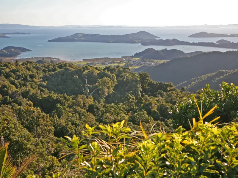
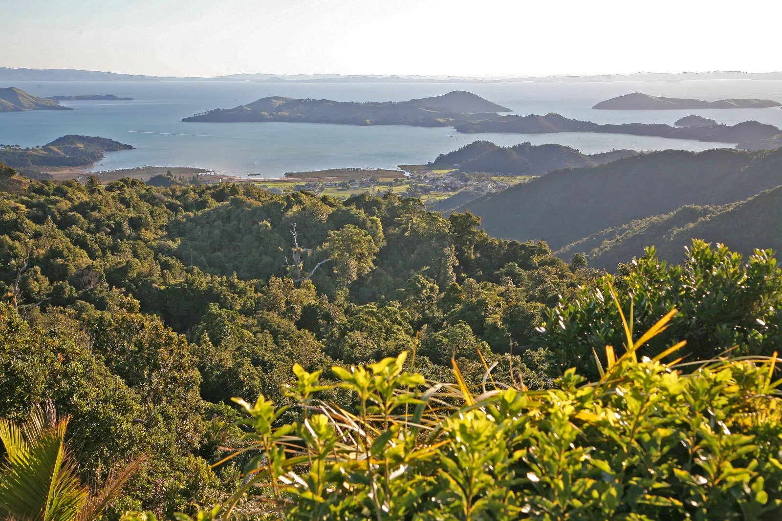
The Coromandel extends roughly 85 km north from the Bay of Plenty, forming a barrier between the sheltered Firth of Thames and Hauraki Gulf on the west and the open Pacific surf beaches on the east. A spine of bush-clad ranges (the Coromandel Forest Park) runs down the middle, which is why there are only a handful of roads crossing it. Think of the map in three bands:
- West coast (Firth of Thames): Thames up through Te Puru and Tapu to Coromandel Town — calm water, mussel farms, gold history.
- The tip: Colville, Port Jackson, Port Charles and Fletcher Bay — remote, gravel roads, the start of the Coromandel Coastal Walkway.
- East coast (Pacific): Whitianga, Hahei, Hot Water Beach, Tairua, Pauanui and Whangamatā — the famous swimming and surf beaches.
Towns at a glance
| Town | Side | Known for | Base for |
|---|---|---|---|
| Thames | West (gateway) | Biggest town, gold-mining heritage, services | The Pinnacles, supplies before heading north |
| Coromandel Town | West/north | Mussels, art, historic gold stamper | The tip, 309 Road, Driving Creek |
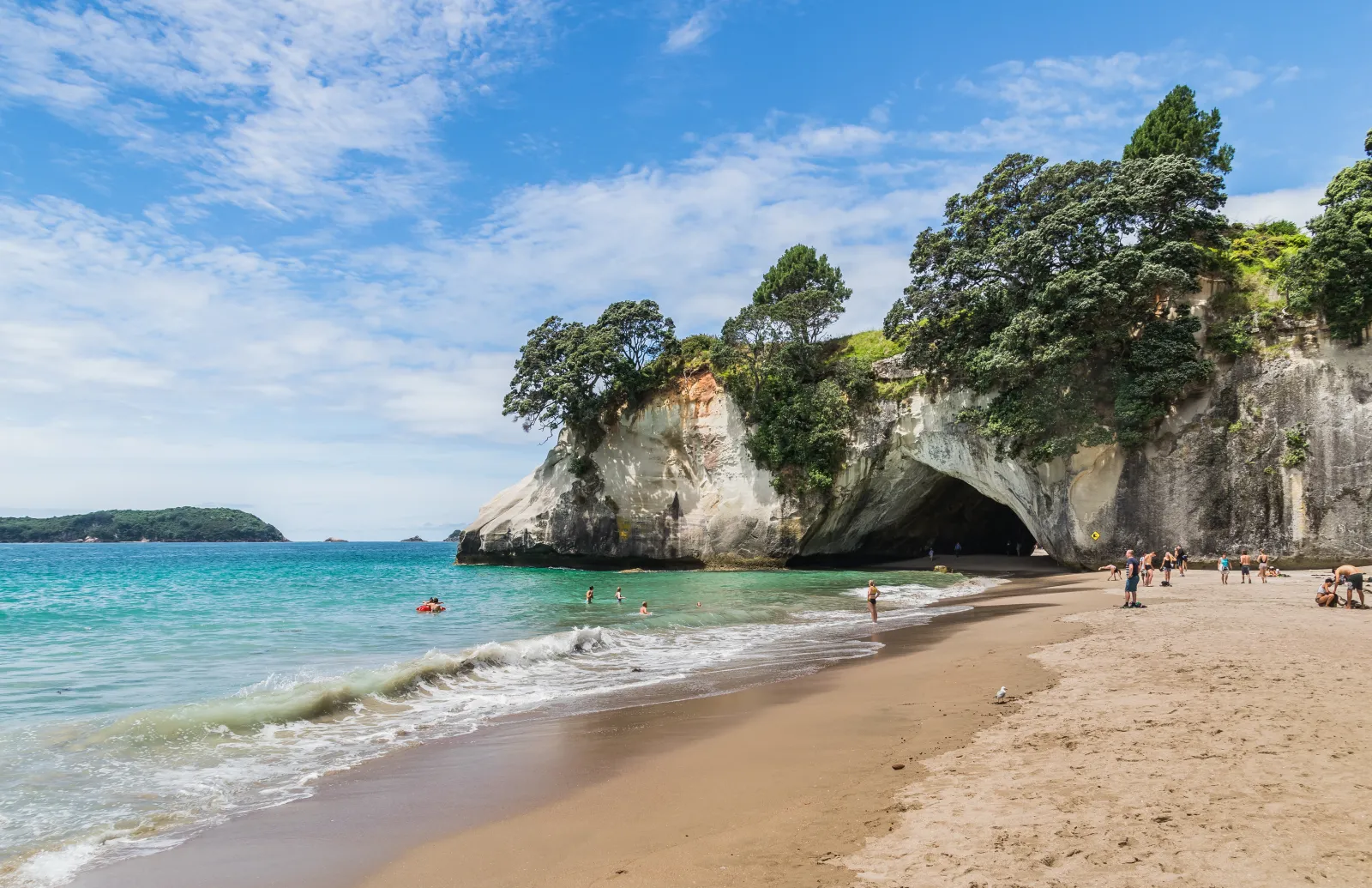
| Whitianga | East | Mercury Bay, ferry, dining | Cathedral Cove, Cooks Beach, fishing |
| Hahei | East | Gateway beach village | Cathedral Cove & Hot Water Beach |
| Tairua / Pauanui | East | Twin harbour towns, Paku lookout | Central east-coast base, surf |
| Whangamatā | South-east | Surf beach, ocean spa, holiday town | Southern beaches, Wentworth Falls |
Distances and drive times
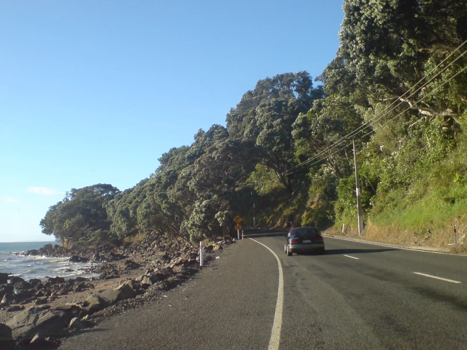
This is the part the map can’t show you. Roads are scenic, narrow and winding, so a “short” distance often takes longer than you’d expect. Figures below are typical driving times — add buffer for photo stops, slow campers and summer traffic.
| Route | Distance | Typical time |
|---|---|---|
| Auckland → Thames | ~115 km | ~1 hr 30 min |
| Hamilton → Thames | ~107 km | ~1 hr 30 min |
| Thames → Coromandel Town | ~50 km | ~1 hr 30 min |
| Coromandel Town → Whitianga (SH25) | ~50 km | ~1 hr |
| Coromandel Town → Whitianga (309 Road) | ~32 km | ~40 min |
| Whitianga → Hahei | ~37 km | ~35 min |
| Whitianga → Tairua | ~42 km | ~1 hr |
| Tairua → Pauanui (by road) | ~25 km | ~20 min |
| Tairua → Whangamatā | ~41 km | ~45 min |
| Whangamatā → Waihi | ~29 km | ~30 min |
Note: Tairua and Pauanui sit either side of the same harbour — a passenger ferry crosses in minutes, but driving between them is ~25 km around the head of the estuary.
The two main driving routes
1. State Highway 25 — the full coastal loop
SH25 wraps right around the outside of the Forest Park: Thames → west coast → Coromandel Town → over the top to Whitianga → south down the east coast to Tairua, Whangamatā and back to Waihi. Doing the whole loop is roughly 4 hours of driving (~216 km) before you stop anywhere, which is why it’s really a two-day trip. This is the route for rental cars and campervans — fully sealed the whole way.
🗺️ Directions (Google Maps)🚗 Open in Waze
2. The 309 Road — the shortcut over the middle
The 309 Road cuts across the ranges between Coromandel Town and the SH25 junction near Whitianga, saving time and passing the Waiau kauri grove and the Waterworks. The catch: a central section is unsealed gravel. It’s fine for a careful 2WD in dry weather, but most rental agreements forbid gravel roads, and it’s best avoided after heavy rain. If in doubt, take SH25.
🗺️ Directions (Google Maps)🚗 Open in Waze
Beyond Colville toward Port Jackson and Fletcher Bay the roads are remote and largely gravel — spectacular, but slow, with limited fuel and phone coverage. Fill up in Coromandel Town first.
Key destinations to pin on your map
Most first-timers build their route around three or four headline spots on the east coast:
- Cathedral Cove — near Hahei; reached by walk, boat or kayak (no direct road to the beach).
- Hot Water Beach — dig your own hot pool around low tide; check the tide times before you go.
- The Pinnacles — the peninsula’s signature hike, up the Kauaeranga Valley inland from Thames.
- Whitianga & Mercury Bay — the east-coast hub for boat trips and dining.
🗺️ Directions (Google Maps)🚗 Open in Waze
For deeper planning, see our local’s guide to exploring the Coromandel, the full things to do round-up, or the Coromandel hub. Driving from the city? Start with Auckland to Whangamatā.
Frequently asked questions
How long does it take to drive around the Coromandel Peninsula?
The full State Highway 25 loop is roughly 216 km and about 4 hours of pure driving with no stops. Because the roads are narrow and winding and you’ll want to stop at beaches and lookouts, treat it as a two-day trip rather than a single day.
Is there a road right around the tip of the Coromandel?
No — there’s no continuous sealed loop around the very top. Roads run out to Port Jackson on the west and Stony Bay on the east, but they’re remote and largely gravel, and the only link across the tip is the walking-only Coromandel Coastal Walkway.
Can I take a rental car on the 309 Road?
The 309 Road is the fast shortcut between Coromandel Town and Whitianga, but a central stretch is unsealed gravel. Many rental agreements don’t cover gravel roads, so check yours first. If you’d rather stay on seal, take SH25 instead — it adds only about 20 minutes.
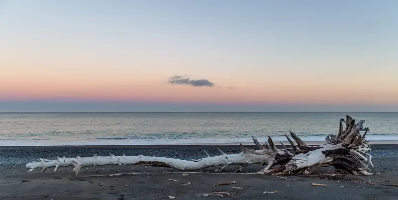
Which side of the Coromandel has the best beaches?
The east coast has the classic white-sand swimming and surf beaches — Cathedral Cove, Hot Water Beach, Hahei, Tairua, Pauanui and Whangamatā. The west coast (Firth of Thames) is calmer and better for sunsets, mussel farms and gold-mining history than for swimming. Always check local conditions and weather before you head out.